← Home · Underground Excavations

Geotechnical Excavation Monitoring in Barnsley

Together, we solve the challenges of tomorrow.

LEARN MORE →

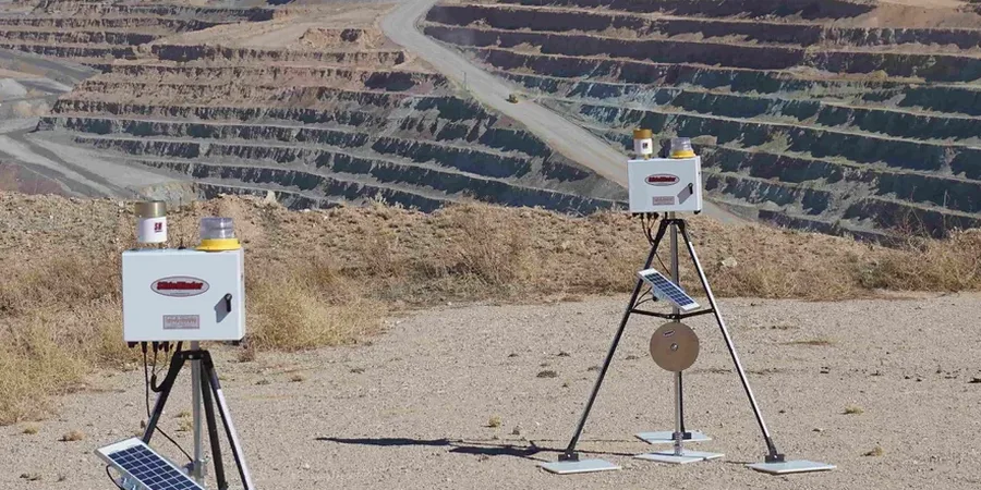
Barnsley’s industrial past left more than heritage buildings. It left a complex subsurface of backfilled shafts, colliery spoil and variable drift deposits. Any cut deeper than a metre can expose surprises that halt works overnight. We run geotechnical excavation monitoring programmes that track wall deflection, groundwater drawdown and vibration before problems escalate. Our team knows the Coal Authority reporting zones. We also know the local ground behaviour—from the Pennine Middle Coal Measures to the glacial till pockets near the Dearne Valley. This isn’t generic instrumentation. It’s monitoring built around Barnsley’s actual ground conditions. For deeper digs near the town centre we often combine monitoring with deep excavation analysis to verify temporary support designs against real-time soil movement.

Real-time ground data prevents costly stand-downs and keeps neighbours confident that their properties are protected.

Our approach and scope

Barnsley sits at roughly 125 metres above Ordnance Datum, with the River Dearne cutting through the centre. That modest elevation hides a legacy of shallow and deep mine workings that amplify settlement risk across the borough. Our monitoring arrays use sub-millimetre precision. Inclinometers track lateral displacement behind retained cuts. Vibrating wire piezometers map pore pressure changes during dewatering. Crack gauges on adjacent structures provide early warning of building distress. Each instrument feeds a central data logger with remote access for the project team. We calibrate trigger thresholds to the specific soil profile—whether it’s stiff boulder clay or weathered mudstone. Where access is tight between existing buildings we add test pit investigations to confirm strata boundaries before placing monitoring points.
Geotechnical Excavation Monitoring in Barnsley
Technical reference image — Barnsley

Local ground factors

The most common mistake we see on Barnsley projects is relying on visual inspection alone. A cut face can look stable for weeks, then fail overnight after a heavy rain event. Without continuous inclinometer data, you miss the creep movement that precedes collapse. Adjacent property owners are quick to claim damage. Without baseline vibration and crack surveys, you have no defence. The Coal Authority also requires proof of monitoring for works within high-risk zones. Skipping proper instrumentation puts your Section 61 consent at risk. We’ve seen site shutdowns that cost more than the entire monitoring budget. Good data protects your programme and your professional indemnity. It also keeps the local authority and insurers satisfied.

Need a geotechnical assessment?

Reply within 24h.

Email: contact@geotechnical-engineering.biz

Technical data

ParameterTypical value
Inclinometer accuracy±0.01 mm/m
Piezometer range0–1,000 kPa
Crack gauge resolution0.01 mm
Vibration sampling rateUp to 500 Hz
Data upload intervalConfigurable from 5 min
Monitoring periodPre-excavation to post-backfill
Compliance standardBS EN 1997-1:2004 + UK National Annex

Other technical services

01

Inclinometer and tilt monitoring

Wall deflection profiles captured continuously or at scheduled intervals. Early detection of excessive movement behind retained cuts.

02

Piezometer installation and reading

Pore water pressure tracking during dewatering. Prevents base heave and verifies drawdown assumptions.

03

Vibration and settlement surveys

Baseline condition surveys plus ongoing vibration monitoring. Protects your position with neighbouring property owners.

04

Automated remote data access

All readings visible on a secure portal. Automated alerts when trigger thresholds are reached. Weekly summary reports included.

Applicable standards

BS 5930:2015+A1:2020 — Code of practice for ground investigations, BS EN 1997-1:2004 + UK National Annex — Eurocode 7: Geotechnical design, CIRIA C760 — Guidance on embedded retaining wall design, Coal Authority requirements for works near legacy mine entries

Quick answers

What’s the typical cost for excavation monitoring on a Barnsley project?

Most small to medium digs in Barnsley fall between £710 and £1,750 for a basic monitoring setup covering inclinometers, piezometers and settlement points over a four-week period. Larger schemes with telemetry and more instruments cost more. We provide a fixed quote after reviewing your ground investigation report and site constraints.

How long does monitoring need to continue after excavation is complete?

We normally recommend monitoring until the permanent works are backfilled and ground conditions have stabilised. For deep digs near mine workings, Coal Authority guidance often requires continued readings for several months post-completion.

Can you install instruments in tight urban spaces?

Yes. We use compact drilling rigs and hand-installed piezometers that work in back gardens, narrow alleyways and between existing foundations. Access constraints are common in Barnsley’s terraced neighbourhoods and we plan the instrument layout around them.

What happens if a trigger threshold is breached?

The system sends an immediate alert to the designated project contacts. We then provide a rapid assessment and recommend actions—this could be slowing excavation, adjusting dewatering or reinforcing temporary supports. Having clear response protocols agreed before work starts keeps the project moving safely.

Location and service area

We serve projects across Barnsley and surrounding areas.

View larger map