The contrast between a project up on the Barnsley Rock escarpment and one down in the alluvial flats of the River Dearne could not be more stark. On the hillside, you are typically socketing into the Pennine Middle Coal Measures—competent sandstone and siltstone—where driven or bored piles find refusal at relatively shallow depths, often less than 12 metres. Move two miles east into the valley, however, and the ground profile shifts to a sequence of soft alluvial clays, silts, and historic mine tailings, where the same pile might need to extend beyond 20 metres to reach a reliable bearing stratum. Designing an efficient pile foundation in Barnsley therefore begins not with the structural loads, but with a forensic understanding of the local drift geology and the legacy of three centuries of shallow coal workings that have left an unpredictable subsurface across much of the metropolitan borough. When the upper soils lack integrity, we frequently combine deep boring data with a CPT test programme to map the transition from soft clays into the competent bedrock before selecting pile type and length.
Socketing piles through Barnsley's former mining zones demands more than bearing capacity—it requires a verifiable collapse assessment of every void within the pile's influence zone.
Local ground factors
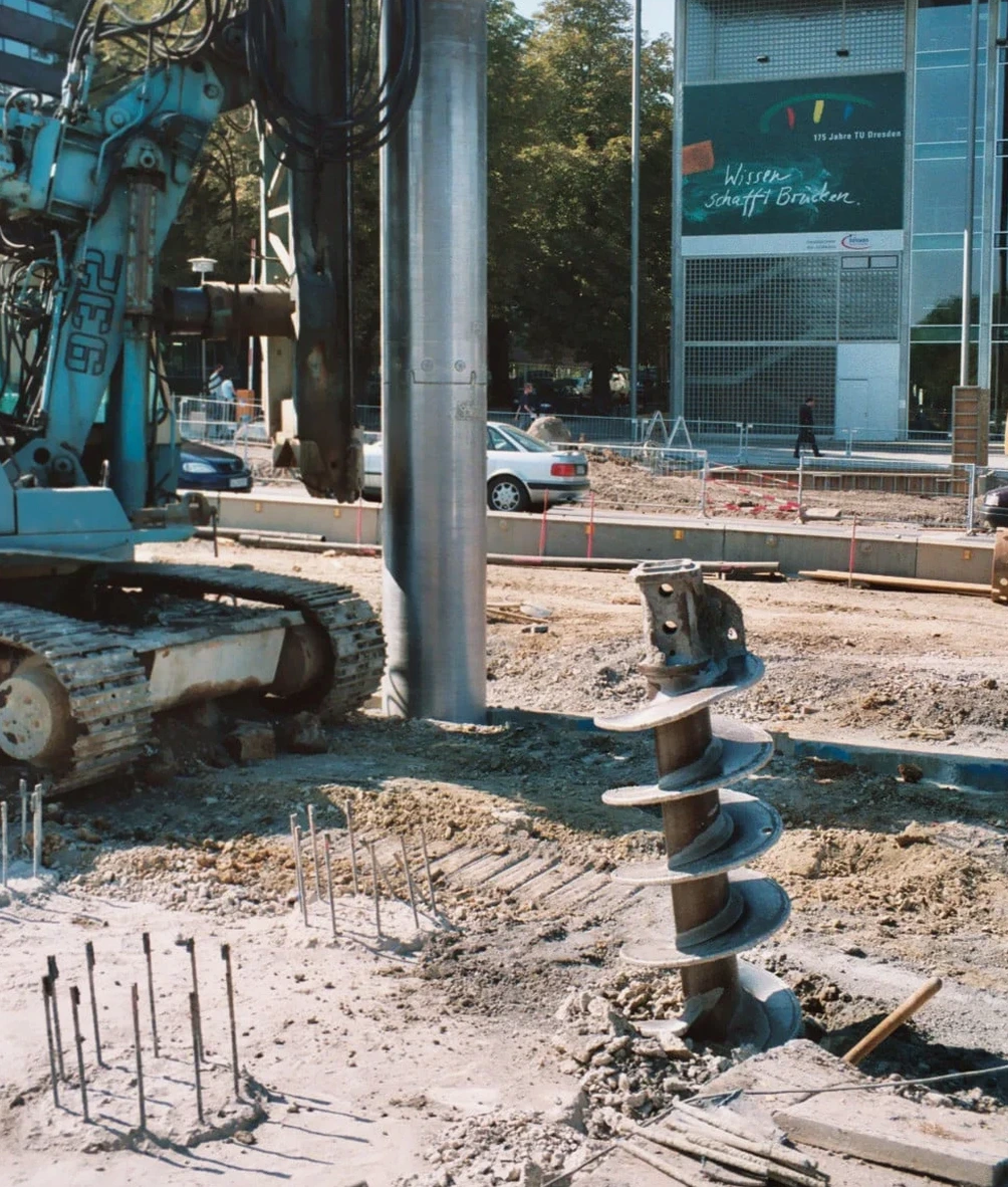
The rig itself tells you a great deal about the ground it is boring through. On a Barnsley hillside site where we are installing continuous flight auger piles into the weathered sandstone of the Pennine Middle Coal Measures, the auger motor torque rarely spikes above 80 bar once it passes through the superficial head deposits. In the Dearne Valley, by contrast, the same rig will fight through 14 metres of soft alluvium before the torque curve begins its steady climb into the rockhead, and the sound of the auger changes from a low rumble to the sharp chatter of cutting sandstone. The risk we are managing in that moment is not merely one of pile length or concrete overbreak—it is the possibility that the soft soils contain compressible peat lenses or, worse, unrecorded mine entries that could collapse under the working load. Our pile designs for Barnsley routinely incorporate a mine entry treatment protocol derived from the Coal Authority's abandoned mine catalogue, and we specify probing ahead of every pile location in zones flagged as high risk. When the borehole log shows granular soils with a high water table, we also evaluate the need for temporary casing or support fluid to maintain bore stability, drawing on deep excavation experience to anticipate collapse mechanisms before they occur.
Applicable standards
BS EN 1997-1:2004 (Eurocode 7 – Geotechnical design, Part 1: General rules) with UK National Annex, BS 5930:2015+A1:2020 (Code of practice for ground investigations), ICE SPERW (Specification for Piling and Embedded Retaining Walls, 3rd edition), BS EN 1992-1-1:2004 (Eurocode 2 – Design of concrete structures, application to piles)
Quick answers
How does the Coal Measures geology in Barnsley affect the choice between driven and bored piles?
The Pennine Middle Coal Measures beneath Barnsley consist of interbedded sandstone, siltstone, mudstone, and occasional coal seams, often with a weathered upper zone that can extend several metres. Driven precast piles can achieve high capacities in the sandstone but risk refusal on unexpected boulders or sloping rockhead, while the vibration may disturb adjacent mine workings. Bored piles—particularly CFA—allow the driller to log the strata continuously and adjust socket length to match actual rockhead conditions. For sites within 20 metres of a recorded mine entry, we typically specify rotary bored piles with temporary casing, as they offer greater control during penetration through potentially collapsed ground above the rockhead.
What are the typical costs for a pile foundation design package in Barnsley?
A complete pile foundation design package for a Barnsley project—including a phase 2 ground investigation with laboratory testing, pile type selection, geotechnical design calculations, and preparation of a piling specification—generally falls within the range of £1,170 to £4,520. The final figure depends on the number of boreholes required, the complexity of the mining legacy assessment, and whether pile load testing is included in the scope. Projects with multiple pile types or those requiring finite element settlement analysis tend toward the upper end of that range.
Is a Coal Authority mining report sufficient to de-risk a piling project in Barnsley?
A Coal Authority mining report is an essential starting point, but it is not sufficient on its own. The statutory report identifies recorded shafts, adits, and shallow workings within the site boundary, yet Barnsley's mining history dates back to the 18th century and many early bell pits and day holes were never mapped. The report must be supplemented by a phase 1 desk study that reviews historical Ordnance Survey maps, geological memoirs, and local authority records, followed by a phase 2 ground investigation that includes rotary drilling with core recovery through any suspected voided horizons. Only when the physical ground conditions have been verified against the documentary evidence can the pile design account for the true mining risk.