← Home · Seismic

Seismic Microzonation Studies in Barnsley: Site-Specific Ground Response

Together, we solve the challenges of tomorrow.

LEARN MORE →

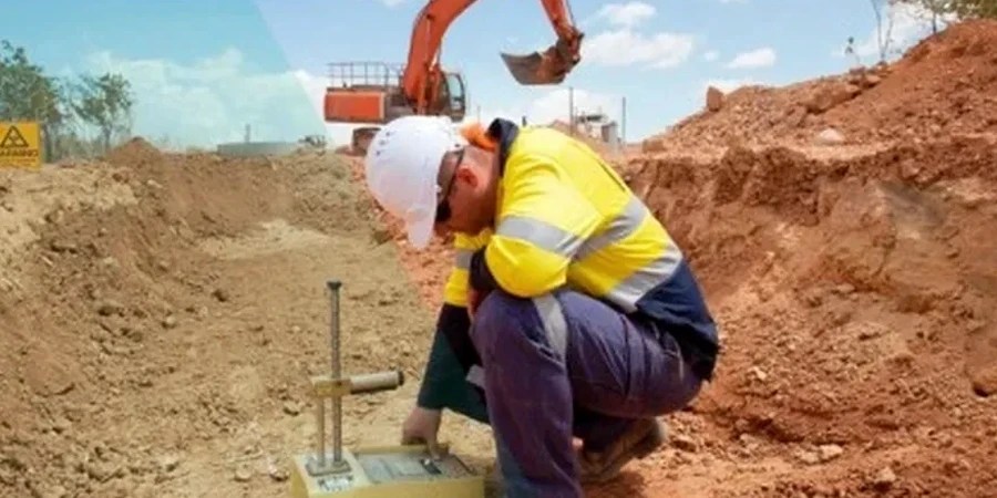
The geophone array is deployed in a linear spread across the site just east of the M1 corridor, where the Coal Measures bedrock lies beneath variable drift deposits. In Barnsley, our field crew uses 24-channel seismographs with 4.5 Hz vertical geophones to capture Rayleigh wave dispersion down to 30 metres, which feeds directly into the VS30 calculation required by BS EN 1998-1:2004. The equipment is calibrated quarterly under our ISO 17025 quality system, and every trigger is stacked three times to suppress ambient noise from nearby roads. Once the raw waveforms are processed, the inversion routine generates a shear-wave velocity profile that reveals the contrast between the loose alluvial silts of the Dearne Valley and the stiffer sandstone bedrock that underlies much of the town centre. This is not a desktop exercise: the data acquisition alone takes a full day on a typical Barnsley brownfield plot, and the interpretation ties into borehole logs where SPT drilling has already confirmed the depth to rockhead.

VS30 is not a soil property; it is a site parameter that must be measured, not inferred, when Eurocode 8 ground-type boundaries are at stake.

Our approach and scope

The ground conditions shift noticeably between the east and west of Barnsley. Around Worsbrough, the Middle Coal Measures sandstone and siltstone are often within five metres of the surface, producing VS30 values above 360 m/s that place the site in ground type B. Move towards the River Dearne floodplain near Lundwood, and the same depth may be dominated by soft alluvial clay and made ground, pulling VS30 below 180 m/s and pushing the classification into type D or worse. These differences matter because a building designed to the same peak ground acceleration will experience fundamentally different spectral accelerations depending on which side of town it occupies. Our microzonation workflow accounts for this by running multiple one-dimensional equivalent-linear site response analyses using DEEPSOIL or SHAKE2000, with input motions selected from the European Strong-Motion Database to match the UK hazard spectrum. Where the alluvium is thicker than ten metres, we also run a liquefaction assessment using SPT blow counts and fine-content data from the lab, because the cyclic resistance ratio in these silts can fall below the factor-of-safety threshold during a rare 2,475-year return period event.
Seismic Microzonation Studies in Barnsley: Site-Specific Ground Response
Technical reference image — Barnsley

Local ground factors

The South Yorkshire climate brings an average of 820 mm of rainfall annually, and the winter months saturate the near-surface clays across Barnsley, raising pore pressures in any naturally occurring silt lenses. When a distant intraplate earthquake of magnitude 5.5 or greater generates long-period motion, these saturated silts can experience a sudden loss of strength that standard bearing capacity checks will not catch. The risk is concentrated along the Dearne Valley and in former mining areas where backfilled shafts and unrecorded workings create an impedance contrast that traps seismic energy near the surface. Our microzonation maps overlay the Coal Authority’s mining reports with the shear-wave velocity grid so that planners can see exactly where two-dimensional basin effects amplify ground motion beyond the one-dimensional assumption. We also integrate the results with slope stability models where the valley sides exceed fifteen degrees, because the pseudo-static coefficient in Eurocode 8 can trigger a translational failure in weathered mudstone that would otherwise appear stable under static conditions.

Need a geotechnical assessment?

Reply within 24h.

Email: contact@geotechnical-engineering.biz

Technical data

ParameterTypical value
VS30 (m/s)140–450 depending on drift thickness
Ground type (BS EN 1998-1)B, C, D mapped by grid cell
Site period T (s)0.15–0.80 from HVSR and downhole
Amplification factor Fa1.0–2.4 per NEHRP provisions
Design PGA (g) for 475yr RP0.04–0.07 adjusted for site class
Depth to bedrock (m)2–25 across Barnsley wards
Liquefaction potential index (LPI)0–12 along Dearne corridor

Other technical services

01

MASW and HVSR Acquisition

Active and passive surface-wave testing using 24-channel arrays and triaxial velocimeters. We process fundamental-mode dispersion curves in Geopsy and invert them for VS profiles to 30 metres depth, delivering the VS30 map and ground-type classification required by Building Control.

02

One-Dimensional Site Response Analysis

Equivalent-linear modelling in DEEPSOIL with modulus-reduction and damping curves calibrated to Barnsley Coal Measures and alluvial soils. Outputs include surface response spectra, amplification factors, and time histories for structural engineers.

03

Microzonation Mapping and Reporting

GIS-based deliverables showing ground-type boundaries, site period contours, and liquefaction susceptibility across the study area. The report is structured for direct submission with a planning application under the NPPF and Local Plan policies.

Applicable standards

BS EN 1998-1:2004 (Eurocode 8), BS EN 1998-5:2004 (Foundations, retaining structures), BS 5930:2015+A1:2020 (Site investigation code of practice), BS 1377/D4428M-14 (crosshole seismic testing), NEHRP 2020 site classification provisions

Quick answers

What does a seismic microzonation study cost for a typical Barnsley development site?

The cost depends on the area to be mapped and the complexity of the drift geology. For a single plot requiring MASW, HVSR, and a site-response report, budgets typically fall between £3,340 and £14,120. A multi-hectare site with a dense grid of measurement points and 2D modelling will sit at the upper end. We provide a fixed-price proposal after reviewing the site location and any existing borehole data.

Is seismic microzonation mandatory for planning in Barnsley?

Barnsley Metropolitan Borough Council may require a site-specific ground investigation that addresses seismic hazard when the development is classed as a major project or lies within an area of former mining. Eurocode 8 compliance is referenced in Approved Document A for structural safety, and a microzonation study provides the site classification and design spectra that satisfy both Building Control and the council's geotechnical consultee.

How long does fieldwork take on a Barnsley site?

A typical MASW and HVSR campaign across a one-hectare site takes one to two days of fieldwork, depending on access constraints and the number of array orientations required. The processing, inversion, and reporting phase adds approximately two to three weeks. We coordinate with any concurrent intrusive investigation so that the velocity profiles can be calibrated against borehole stratigraphy.

Can you integrate microzonation results with existing borehole data?

The reference range for this service in Barnsley is £3.340 - £14.120. The final price depends on the project scope and volume.

Location and service area

We serve projects across Barnsley and surrounding areas.

View larger map