Barnsley sits on ground that's seen more change than most places in South Yorkshire. The legacy of deep coal mining, combined with thick glacial till and pockets of alluvium along the Dearne, means you can't take the ground at face value. A stiff clay at surface might overlie old workings at ten metres, or a sandstone outcrop might be fractured and weathered far deeper than expected. The Standard Penetration Test gives us a direct, repeatable measure of soil consistency and relative density at depth. When we combine that with detailed logging to BS 5930:2015, we build a ground model that tells the full story. For projects near the town centre or out toward Dodworth and Worsbrough, running an SPT programme is the difference between designing a foundation that works and one that's guessing at what lies beneath.
In Barnsley's Coal Measures, the SPT doesn't just measure strength, it flags the transition from weathered to competent rock that governs pile toe levels.
Our approach and scope
The geology under Barnsley is dominated by the Pennine Middle Coal Measures Formation, a sequence of interbedded sandstones, siltstones, mudstones, and of course the coal seams that powered the town's growth. Overlying much of this bedrock is a blanket of glacial till, or boulder clay, which can vary from a stiff sandy matrix to a softer, water-bearing deposit. SPT N-values here typically range from 8 to 15 in the weathered upper till, rising to 25+ in the underlying mudstone. The real challenge is the variability: you can drill two boreholes fifty metres apart and find completely different conditions.
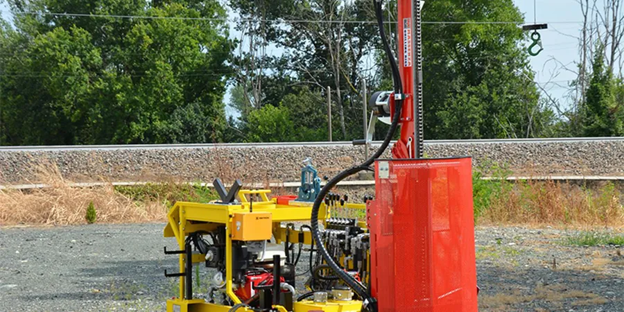
Our SPT work in Barnsley follows the procedures set out in BS EN ISO 22476-3, using an automatic trip hammer and calibrated energy ratio where required. We report uncorrected N, N60, and (N1)60 values so your structural engineer can apply the appropriate bearing capacity factors. For sites near the river, where granular alluvium is present, we pair SPT data with
grain-size analysis to confirm the grading and assess liquefaction potential under Eurocode 8. The combination of in-situ testing and lab verification gives a level of confidence that saves time and steel in the final design.
Local ground factors
The ground risk profile between Barnsley town centre and the outskirts toward Silkstone is fundamentally different. In the central area, the main concern is mine workings: unrecorded shallow shafts and abandoned roadways that can collapse under load. An SPT refusal on what should be competent rock often signals a void or a zone of collapsed ground, not solid strata. Out toward the west, where the landscape rises into the Pennine foothills, the risk shifts to slope instability in the weathered mudstone and the presence of boulder clay that can slide on polished bedding planes. We've seen projects where ignoring these differences led to foundation redesigns mid-construction, costing weeks and tens of thousands in variations. A well-spaced SPT investigation, interpreted by someone who knows the Coal Measures, catches these problems long before the first excavator arrives on site.
Quick answers
How much does an SPT borehole investigation cost in Barnsley?
For a typical domestic or light commercial project in Barnsley, a single borehole with SPT testing at standard intervals, including mobilisation, drilling, logging, and a factual report, falls in the range of £480 to £680 plus VAT. The final cost depends on access constraints, depth required, and whether rotary coring into rock is needed. We provide a fixed quote after reviewing your site location and proposed foundation loads.
How deep do you need to drill SPT boreholes in Barnsley for a house extension?
For a single-storey extension on strip footings, we typically drill to 6 to 8 metres below ground level, which is enough to penetrate the weathered till and confirm the top of competent Coal Measures. If the site is within a Coal Authority Development High Risk Area, we may recommend going deeper, to 10 or 12 metres, to prove the absence of shallow workings beneath the proposed foundation zone.
What's the difference between SPT N-value and N60?
The raw SPT N-value is the number of blows to drive the sampler the last 300 mm. N60 corrects that raw number to a standard 60% hammer energy efficiency, because different rigs and hammer types deliver different energy. In the UK, automatic trip hammers often deliver around 70-75% energy, so the N60 is slightly higher than the raw N. For foundation design, we always report both values and, where relevant, the (N1)60 normalised for overburden pressure.
Can SPT testing detect old mine workings under my Barnsley site?
An SPT alone cannot confirm a mine working, but it provides strong indirect evidence. A sudden drop in N-value to zero or near-zero, combined with drilling water loss and rod drop, suggests a void or collapsed ground. We correlate these indicators with Coal Authority mine abandonment plans and, if necessary, recommend follow-up rotary drilling with core recovery to confirm the extent and condition of any workings.
How long does an SPT investigation take, and will it disrupt my site?
A single borehole to 10 metres depth with SPTs at 1-metre intervals is usually completed in one working day. The rig footprint is roughly the size of a small van, and we can work from a hardstanding or compacted stone access. There's some noise from the drop hammer and the drilling itself, but we manage working hours to minimise disruption. You'll have a draft factual log within 48 hours of completing fieldwork.